Course Maps
2021 Course Maps
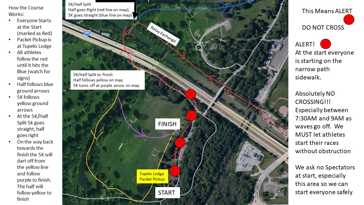
(Please note: at the request of the City of Rochester the start/finish has been moved to Genesee Valley Park)
5K Course - Follow YELLOW Arrows on the Ground - it's the same color as your bib
Half Course - Follow the BLUE Arrows on the Ground - it's the same color as your bib
2021 Half Marathon Course Map on MapMyRun
2021 5K Course Map on MapMyRun
About Genesee Valley Park:
Genesee Valley Park is a Fredrick Law Olmsted-designed park that is dominated by three intersecting waterways, Red Creek, the Genesee River and the New York State Barge Canal.
At 800 acres, the park is an ideal access point to a major network of trails along the river and canal as well as the route 390 bike trail and the Genesee Valley Greenway. Also included in the park are softball diamonds, multi-use/soccer fields, a cricket pitch and two 18 hole golf courses.
The Start & Finish are on the South Side of the Park by the East River Rd Entrance by Tupelo and Hawthorne Lodges. You can enter via Moore Road as well. Map of Park Park Information
The 2021 Course:
There will a separate start and finish line to reduce social gathering. All events will begin at the same location and finish at the same location. These are situated on the southern side of the Park. The course itself is flat and fast. Athletes will be able to get views of the historic Genesee Valley Riverways and River itself. The Half Marathon will have two magnificent views of the City of Rochester, in addition to sights of the University of Rochester campus..
For Historical Purposes below is the original course if you'd like to run it for your Virtual Event
Half Marathon Course Map on MapMyRun
Half Marathon USATF Course #NY10109KL Map
Half Marathon Tic Sheet - PDF Format
Detailed Mt. Hope Cemetery Map PDF Format